Flight Plan
New to the aera 760, pilots can load departures, arrivals and instrument approach procedures (IAPs) within a flight plan, which can be wirelessly transferred to a navigator in the cockpit.
- View the chart or overlay it on the moving map
- IFR enroute charts, VFR sectionals and Garmin FliteCharts® are also geo-referenced
- Jeppesen electronic charts are compatible with the Garmin aera 760 portable aviation GPS and give customers worldwide access to instrument approach chart information
- In addition to procedures, victor airways, user-defined holds and holds over an existing navigation fix can be entered into a flight plan
Connext Wireless Connectivity
Built-in Wi-Fi® and Bluetooth® allow the aera 760 to take advantage of Garmin Connext wireless connectivity inside and outside of the cockpit.
- Download aviation database and software updates without the need to physically connect it to a computer.
- Prior to departure, pilots can also view worldwide weather information on the Garmin aera 760 handheld aviation GPS when it’s connected to Wi-Fi.
- Wirelessly connect to products such as the GTX™ 345 or the GDL® 52 to display the benefits of Automatic Dependent Surveillance-Broadcast (ADS-B) traffic, Flight Information Service-Broadcast (FIS-B) weather, SiriusXM aviation weather and more via Bluetooth.
- Exclusive features such as TerminalTraffic™ and TargetTrend™ can also be viewed on the moving map and dedicated traffic pages.
SIRIUSXM® SERVICE - When paired with an optional GDL® 51 or GDL 52 datalink receiver, aera 760 can incorporate SiriusXM satellite weather coverage — plus audio entertainment features.
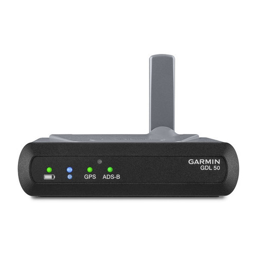
ADS-B DATALINKS - With available Garmin ADS-B “In” solutions (such as the GDL 50 Series), the aera 760 displays ADS-B traffic targets as well as subscription-free U.S. weather data — either wirelessly or with an optional power/data cable.
3D VISION - 3D Vision technology gives you a virtual 3D behind-the-aircraft perspective view of surrounding terrain, obstacles and airports, as well as traffic (when equipped with ADS-B “In”).
SYNTHETIC VISION - View Synthetic Vision (SVX™) by panel-mounting your aera 760 and using its built-in AHRS, or by connecting it to another device with an AHRS, such as a GDL 52 series datalink.
TERRAIN ALERTING - See your position above terrain and obstacles on the map and profile view. Obstacles within 1,000 feet (or a pilot-customizable height) are highlighted yellow, while obstacles within 100 feet are highlighted red.
WIREAWARE™ - Garmin WireAware wire-strike avoidance technology graphically overlays Hazardous Obstacle Transmission (HOT) lines that span rivers and canyons right on the moving map.
STREET INTERSECTIONS - Optional maps allow pilots to enter street intersections and other non-aviation waypoints for easy navigation.
ELECTRONIC FLIGHT BAG - The aera 760 fulfills the role of an electronic flight bag, with georeferenced charts, pdf viewer, E6B computer, weight-and-balance calculator, logbook and more.
FUEL PRICES - Fuel price data can be overlaid on the map for at-a-glance awareness of the prices in an area — or viewed on the airport directory page.
AIRPORT INFORMATION - Touch an airport symbol on the map to view its airport information page, and see runways, frequencies, NOTAMs, FBOs and more.
BATTERY LIFE - Get up to 4 hours of flight time on each charge, or easily power it in-flight with a USB-C cable.